

Greater Hyderabad is a mega city that spans a range of over 600sq. km. of municipal corporation area and around 7,000sq. km. of a metropolitan area. The city has reached a level where it is currently the busiest hub of IT, Biotech, Pharmaceuticals and Tourism sectors throughout India. Its strategic geographical location, multilingual and cosmopolitan culture, tremendous growth potential and investment-friendly economic policy are all making it an attractive destination for corporates, entrepreneurs, academicians and homemakers alike.
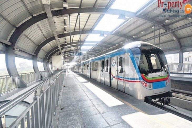
A people-friendly city is that which provides a good quality of life needs an eco-friendly method of transport, these trains cause no air pollution and curb sound pollution. They will reduce travel time greatly.
Following is an estimate of what this 3 corridor system is capable of:
Corridor 1(RED Line) - which runs from Miyapur to L.B. Nagar, a total of 27 stations (Crossing over At Ameerpet - Connecting Corridors 1 and 3 and at Mahatma Gandhi Bus Station - Connecting Corridors 1 and 2) is covered in 45 mins
Corridor 2(BLUE Line) - JBS to Falaknuma, rounding 15 Stations(Crossing over At Ameerpet - Connecting Corridors 3 and 1 and At Parade Grounds - Connecting Corridors 3 and 2) takes around 22 minutes for the route to be completed.
Corridor 3(GREEN Line)- Nagole to Shilparmam 24 Stations(Crossing over At Parade Grounds - Connecting Corridors 2 and 3 and At Mahatma Gandhi Bus Station - Connecting Corridors 1 and 3) can be cleared in 39 minutes.
All stations will have air-conditioned mini-bus services, connecting nearby colonies, business establishments, and other popular places, all of them will have smart card-based ticketing & gate systems for passenger convenience. A range of aesthetics is being designed to reflect the local architecture, latest trends, and to minimize demolitions. As far as possible, parking and circulation areas will be developed on nearby Govt. lands.